No tornadoes today, just miles and miles of sunny, open road. I covered nearly all of New Mexico and half of Arizona today, positioning myself for a run across the desert tomorrow.
Both New Mexico and Arizona built Interstate 40 the same way: paralleling rather than replacing Route 66 where the terrain permitted, and looping around the business district of the significant towns en route so that "Business Route 40" followed old 66 through town. As even the largest communities along the route depended heavily on revenue from tourists passing through on their way to California, these Business Routes often contain dozens of photogenic old motels, cafes and the like. Since I don't have the patience to dodge traffic long enough to photograph everything which catches my eye, guess I'll just have to swing back through here again sometime...
Nowhere is this more apparent than Albuquerque, where Central Avenue presents an 18-mile-long tour of roadside businesses from the 1930s to the present. I found a number of motels which look just as they did in 45-year-old postcards. One, the El Vado, proudly boasts that it's been catering to Route 66 tourists for 61 years. A grad student in historic preservation might find a fine thesis topic here; I settled for about a dozen photographs.
As further evidence that tourism has long been the biggest business along this stretch of Route 66, at least 90% of the land between towns is used (if at all) to graze cattle. There's not enough water to grow crops, and not enough people to require other uses for the land. And every 20 miles or so, another barrage of billboards points the way to an "Indian trading post" or other combination souvenir store/lunch counter. In New Mexico, most of these are part of larger chains, while in Arizona individual imagination runs wild: the Jack Rabbit, Meteor City, Two Guns, Twin Arrows and many others dot the landscape, with a concentration of tepees (and even an Indian-run Fort Courage Trading Post -- wonder how many of today's tourists still remember "F Troop"?) near the New Mexico line.
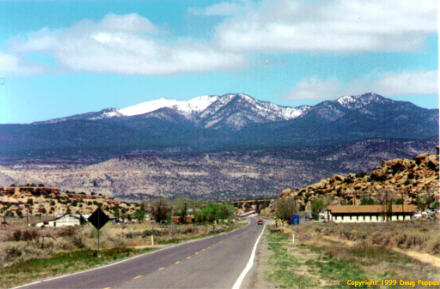
That landscape begins as green fields in eastern New Mexico, becoming redder and hillier across the western quarter of the state and desolate reservation land in Arizona. The land steadily rises when driving east to west, reaching an altitude of more than 7,200' in western New Mexico, before leveling off at a level which ensures temperatures 10-15 degrees lower than Amarillo's. I was delighted when I stepped out of the car, less so when I tried to walk any significant distance. After leaving Tucumcari this morning, I swung through Santa Rosa to mourn the passing of the Club Cafe, which closed about two months after my last visit to the area. For decades the Club Cafe had lured patrons through a series of billboards depicting a smiling, satisfied fat man (who looked a lot like Rush Limbaugh, in fact), but it succumbed a few months after a McDonald's opened at the edge of town.
Old motels seem to fare better -- many are still operated at rates of less than $20/night, with others converted into cheap apartments or even storage lockers.
Stopped at several Indian-themed souvenir stores without buying anything. I didn't need moccasins, Navajo rugs, beads, steer horns, turquoise bracelets or necklaces, or additional black velvet art. At least two such stores, operated by Navajo on their reservation, tempted tourists with Taco Bell Express... Almost bought a rubber band gun -- a carved block of wood with clothespins mounted on top -- for the office, but decided it wasn't a good idea to be passing through airport security with any gun-shaped object. (Cliff, you should be thankful, since you'd have been in my direct line of fire.)
The authors of one Route 66 guide have done an outstanding job tracking down abandoned but drivable sections of the road in eastern Arizona, so I spent quite a bit of time on dirt roads through this area. Even found time to enjoy Nature, visiting the Painted Desert/Petrified Forest National Park in eastern Arizona. Removing even a sliver of petrified wood in the park is a Federal offense, but the tourist who wants to take some home need only visit the shops located just outside park boundaries.
Winslow, Arizona is trying desperately to capitalize on its mention in the Jackson Browne/Eagles song "Take It Easy." There's an Official Corner downtown, on which one can stand while looking for that girl, my Lord, in a flatbed Ford, slowing down to take a look. The town's even building a park to honor the fictional corner. Will this become a trend? If so, I'll urge New York to mark the corner of Lexington Avenue and 125th Street, where Lou Reed scored heroin in " I'm Waiting for the Man." Route 66's final street, Santa Monica Boulevard, figures prominently in Sheryl Crow's " All I Wanna Do" -- what about a statue of a tipsy, miniskirted party girl to mark journey's end?
Tomorrow I'm aiming for the outskirts of metropolitan Los Angeles -- a base camp from which to launch my final assault on Friday morning. Late afternoon sun can create interesting light effects for photography, but it's hell when you're driving west. When I head back east on Monday morning, I'll have the pleasant task of avoiding the dawn sun...
Go to the next day
Back to NEWS FROM THE ROAD menu
Back to ROADSIDEPHOTOS.COM home page