Across the rest of Oregon and most of Idaho, the road builders hadn't been able to decide what to do with US 30. Sometimes it was part of the Interstate, sometimes it veered off on a loop or tangent, and sometimes it existed as an unmarked road next to the section of Interstate now designated as US 30. Oregon roads had two unusual characteristics: the speed limit signs said only "SPEED 55," with the 55 in larger numerals than on a conventional sign, and about 1/4 of the US 20/US 30 signs marking the roads were of the older design -- smaller, with no black background on the shield and usually with the state name inside the shield above the number.
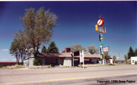
A couple of the Oregon towns, Haines and Baker, were classic Old West towns -- wide main street with old buildings on either side, selling nothing fancy. Today, at least, I'd have no trouble finding places to eat, since the road passed near or through every major city for 400 miles.
However, there wasn't much worth photographing. The tall dunes of eastern Oregon gave way to the flatter agricultural land of Idaho without producing anything much of interest. One exception was the ironically-named town of Bliss, Idaho, at the western end of US 30's "scenic route" to Twin Falls: the first three buildings I came to in Bliss were all abandoned structures which had formerly catered to tourists. I stopped briefly at the Hagerman National Fish Hatchery (lots of very small fish in runs; the bigger ones, all 1.6 million of 'em, had been released into the Snake River a month or so ago) and gazed at the Thousand Springs, outlets for the Lost River which disappeared into lava flows over 100 miles to the northeast. Persistent stuff, that water...
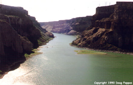
Shoshone Falls illustrated the stupidity of some government projects. In order to irrigate some additional cropland upstream, which almost certainly served only to add to the nation's agricultural surplus, the Corps of Engineers had diverted almost all the Snake River's water to irrigation 20 miles upstream from this 212' high falls. The cliffs, and a few small streams of water, were visible from the overlook, but the beauty of the scene was compromised by the ugly structure and lack of water.
As I continued east, I found a few Oregon Trail monuments. At one interstate rest area, a small detour led me to an area from which I could see original Oregon and California Trail ruts, still in the surface after 140 years. A little later came Register Rock, on which many earlier travelers had inscribed their names. Stopped for the night in Pocatello.
Go to the next day
Back to Old Road Trips menu
Back to ROADSIDEPHOTOS.COM home page