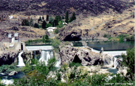
Greetings from Ontario, Oregon, just across the Snake River from Harmon Killebrew's hometown of Payette, Idaho and near Weiser, Idaho, where Walter Johnson was discovered.
Today's fun began even before I reached the Oregon Trail. An advertising card in my motel room announced that the Ranch Hand Truck Stop, just a mile up the road, served the "Best Truck Stop Breakfast in America," according to a national poll of drivers. I had to see for myself.
When I sat down to order, I was both the youngest patron and, frighteningly, the neatest. A good sign. My delicious omelet was accompanied by a huge platter of home fries and two large, freshly baked biscuits. The biscuits, in turn, were accompanied by fresh butter, three kinds of jelly (Smucker's single-serve portions, not homemade), and that disgusting white cream gravy so popular in the South and Midwest. Best truckstop breakfast in America? It's a contender, and I'm sure as hell not planning to sample enough competitors to make an informed judgment.
Back on the Trail, I continued to Hooper Spring, on the outskirts of Soda Springs. The town was named for the numerous mineral springs which once bubbled to the surface. Most of the others were inundated by a nearby reservoir, but Hooper Spring water remains fresh and free for the taking. It tastes like metallic Perrier -- with proper marketing, I'm sure pretentious twits could be induced to pay $1.50/bottle.
Had to skip Fort Hall, the next Trail landmark, which is no longer freely accessible to the public. The fort sits on the Shoshone-Bannock Reservation; Anglos visiting without a licensed Indian guide are subject to arrest. (As the guidebook notes, "Forget, hell. The last time the American Indian allowed trespassers on his land he lost the whole damned West.") Without the time to track down a guide and without the inclination to turn this trip into an investigation of comparative penal systems, I turned west to follow the Snake River across Idaho.
Many of the best Trail sites across Idaho have nothing to do with the emigrants, and everything to do with the river. Unfortunately, modern river management has ruined the most spectacular sights: the flows over American Falls, Shoshone Falls and half of Twin Falls have been diverted to hydroelectric power and crop irrigation. Those potatoes don't grow on trees...
Massacre Rocks State Park commemorates an Indian attack and also shows a result of America's greatest flood. Dozens of car-sized rocks line the path, 50 feet above the Snake River's current water level -- they were stranded some 15,000 years ago, when the thousand-square-mile Lake Bonneville burst through to the Snake River. Almost the entire lake drained in just two months, leaving the Great Salt Lake and a dry, flat lake bed perfectly suited for automobile speed trials. A few miles away, another state park protects Idaho's version of a Register Rock. This one's smaller and has fewer signatures than its Wyoming counterpart -- perhaps the novelty had worn off.

A more modern landmark stands just north of the town of Twin Falls: the site of Evel Knievel's ill-fated attempt to jump the Snake River Canyon in a rocket-powered vehicle. The locals foolishly emphasize the history and the views instead of sponsoring an annual Jump-Off which could remove from the gene pool some of the sorriest specimens of humanity while providing Fox with a year's worth of prime-time specials. Forty miles ahead, migrants and today's traveler alike are startled by the sudden appearance of the Thousand Springs, which erupt from a sheer cliff wall. In fact, the Springs are the southern outlet of the Lost River, which pours into lava formations more than 100 miles to the northeast and flows underground to this point.
Further west, the town of Rattlesnake concluded it would attract more settlers by changing its name to Mountain Home. It's attracted a military base and a K-Mart/Wal-Mart shopping complex the size of an auto assembly plant, but not many residents. The next major Oregon Trail site is Bonneville Point, an overlook from which an early French explorer first spotted the woods which gave Boise its name.
No trace of the Trail remains within Boise and environs -- for which I was grateful, since I was falling behind schedule. Instead, my final Idaho stop was the marker identifying the site of the original Fort Boise, on the waterfront but accessible only via a 1-1/2 mile, one-lane gravel road with occasional turnouts.
Tomorrow it's on to Oregon City and the end of the Trail -- hopefully with enough time to visit Powell's Books in Portland, America's best bookstore, before heading for the coast and Route 20. Later...
Go to the next day
Back to NEWS FROM THE ROAD menu
Back to ROADSIDEPHOTOS.COM home page