| |
Wednesday, September 5, 2000...
Greetings from Tigard, Oregon, 10 miles south of Portland, where thanks to recent business consolidations one motel loop contains two Union 76 stations 200 feet apart and two Motel 6s across the street from one another.
Today's first stop illustrated the maxim, "don't believe everything you read." In 1852, one John D. Henderson collapsed and died just south of what's now Vale, Oregon. Contemporary accounts made clear that he succumbed to disease. However, an official plaque above his grave tells a tragic tale: weakened by a long hike, Henderson died of thirst without knowing he was less than half a mile from fresh water. Trail historians traced this tale back to the 1930s, when it was invented by a third grader who had been asked to write a story about Henderson.
Had planned to continue north along a gravel road built directly over the Trail, but before I could get there it started to rain. So much for that idea. I returned to the Interstate and headed north to Farewell Bend State Park, where the emigrants left the Snake River to angle northwest across a series of mountains to the Columbia River. (North of here the Snake enters impenetrable Hells Canyon.) These mountains are probably the steepest on the entire Trail -- even with modern roadbuilding technology, the Interstate descends one hill at a 6-degree slope for six miles, with numerous runaway-truck ramps along the way.
The rain increased as I neared the next stop, the National Historic Oregon Trail Interpretive Center atop Flagstaff Hill, east of Baker City. This was a real loss: this site had been selected for the multimillion-dollar Center because of its spectacular views and miles of intact trail ruts, But the Center itself, which opened just a few years ago, has so much good stuff that I stayed an hour anyway.
By this point I was worried that the rain would accompany me all the way to Portland, ruining so many sights that I'd feel compelled to come back on a later trip. But the rain stopped as soon as I left that valley, and the sun was out long before I reached the Columbia. Along much of this drive I followed the route of the "Old Oregon Trail," a contemporary of the Lincoln Highway which was later marked at US 30. (The Lincoln Highway became US 30 from Philadelphia to western Wyoming; for the rest of the way, 30 followed the Old Oregon Trail.) A display at the Trail Center mentioned that President Harding had dedicated a marker in early July 1923, at which time he was presented with a lifetime membership in the Old Oregon Trail association. Harding was dead within a month...
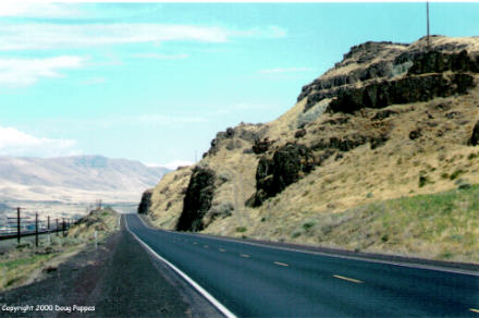
At the Blue Mountain Crossing, the Bureau of Land Management maintains both a set of Oregon Trail ruts and the ruts from the stagecoach run which succeeded it in the 1860s. Further on, past Pendleton, the route of the Trail was simply paved and widened for old US 30, which swoops up and down hills near a river while the nearby Interstate simply blasts its way through.
 By Biggs, Oregon, just across the Columbia from Sam Hill's full-sized Stonehenge replica, the emigrants were over the mountains and headed for water. Most floated down the Columbia from The Dalles to Portland; since I couldn't follow that route, I simply paralleled it on the Interstate. With a little more time, I would've turned off to follow the Columbia River Scenic Highway past a half-dozen waterfalls. 630' Multnomah Falls has its own parking area in the median of the Interstate, but a glimpse revealed that the water flow was way down. Could be out here again next May on the first road trip of 2001 -- if so, I'll catch the Falls in a better season.
Before turning south to the official end of the Trail in Oregon City, I crossed the Columbia to Fort Vancouver National Historic Site, in Vancouver, Washington. Here and elsewhere along the Trail, "fort" meant "trading post," not "military installation" -- in this case, an outpost of England's Hudson's Bay Company which serviced the fur-trapping industry. John McLoughlin, the Canadian in charge of the operation, offered supplies on easy credit to settlers; he did such a good job that the flood of emigrants from the East caused the U.S. to pressure Britain into withdrawing further north. When they did, McLoughlin moved down to Oregon City, where he became known as the "Father of Oregon."
The final set of Trail sites are located in Oregon City, but I got there after they'd closed. A huge new End of the Trail museum occupies three connected buildings designed to resemble 50' high covered wagons, while half a mile away, McLoughlin's original house still stands. My voyage along the second half of the Oregon Trail ended shortly before 6:00 tonight.
After checking into my room, I drove up to Powell's City of Books in downtown Portland. The three-story warehouse, occupying a full city block, contains more than 1,000,000 new and used books, organized into hundreds of categories and displayed in roomy, well-lighted aisles. Everything's available on the Web -- and since shipping is free on all orders of $50 or more, I just scribbled down what I want and will order it online to avoid carrying it home.
Once I drive to the coast tomorrow morning, the rest of the route is Z-shaped: east on US 20, southwest across Idaho and Nevada to Bishop, California, then east on US 6 from Bishop to Denver. After the past four days, it'll feel weird to drive without having to navigate with two books on the seat next to me...
By Biggs, Oregon, just across the Columbia from Sam Hill's full-sized Stonehenge replica, the emigrants were over the mountains and headed for water. Most floated down the Columbia from The Dalles to Portland; since I couldn't follow that route, I simply paralleled it on the Interstate. With a little more time, I would've turned off to follow the Columbia River Scenic Highway past a half-dozen waterfalls. 630' Multnomah Falls has its own parking area in the median of the Interstate, but a glimpse revealed that the water flow was way down. Could be out here again next May on the first road trip of 2001 -- if so, I'll catch the Falls in a better season.
Before turning south to the official end of the Trail in Oregon City, I crossed the Columbia to Fort Vancouver National Historic Site, in Vancouver, Washington. Here and elsewhere along the Trail, "fort" meant "trading post," not "military installation" -- in this case, an outpost of England's Hudson's Bay Company which serviced the fur-trapping industry. John McLoughlin, the Canadian in charge of the operation, offered supplies on easy credit to settlers; he did such a good job that the flood of emigrants from the East caused the U.S. to pressure Britain into withdrawing further north. When they did, McLoughlin moved down to Oregon City, where he became known as the "Father of Oregon."
The final set of Trail sites are located in Oregon City, but I got there after they'd closed. A huge new End of the Trail museum occupies three connected buildings designed to resemble 50' high covered wagons, while half a mile away, McLoughlin's original house still stands. My voyage along the second half of the Oregon Trail ended shortly before 6:00 tonight.
After checking into my room, I drove up to Powell's City of Books in downtown Portland. The three-story warehouse, occupying a full city block, contains more than 1,000,000 new and used books, organized into hundreds of categories and displayed in roomy, well-lighted aisles. Everything's available on the Web -- and since shipping is free on all orders of $50 or more, I just scribbled down what I want and will order it online to avoid carrying it home.
Once I drive to the coast tomorrow morning, the rest of the route is Z-shaped: east on US 20, southwest across Idaho and Nevada to Bishop, California, then east on US 6 from Bishop to Denver. After the past four days, it'll feel weird to drive without having to navigate with two books on the seat next to me...
Go to the next dayBack to NEWS FROM THE ROAD menuBack to ROADSIDEPHOTOS.COM home page
|