Greetings from Ely, Nevada, the remotest town of any size in the lower 48 states. With about 5,000 residents, Ely is the largest community for 200 road miles in any direction.
This was a fitting end to a day which began in Wyoming, the least populated state. On a map, the trip from Cheyenne to Laramie doesn't look like much -- 45 miles in a 400-mile-wide state - but the route passes over 8,800' Sherman Summit, highest point on the Lincoln Highway, I-80 and the transcontinental railroad. The highway summit is marked by the world's largest bronze head -- a bust of Abraham Lincoln, carved by a not especially talented Wyoming artist, that stares down from a rest area at the Interstate. It originally stood along the Lincoln, but was moved after the completion of I-80.
Highway officials may have learned from the railroad's mistake. The Union Pacific spent $65,000 (in 1880 dollars!) to construct a 60' pyramid at its highest point. When the tracks were relocated, the Ames Monument couldn't follow; today it sits alone and nearly forgotten, two miles down a dirt road. Another obscure monument sits just off the Lincoln at the Continental Divide: a memorial to Henry B. Joy, one of the movers behind the Lincoln Highway. The Joy Memorial isn't even marked; it can be reached only by leaving the Interstate, turning half a mile west down the gravel roadbed of the original Lincoln, then lurching up a steep, rocky dirt road to the top of a small hill.
Between Rock Springs and Green River, the Lincoln weaves through beautifully eroded rock formations. The cause of the erosion is easy to guess -- this is one of the windiest places this side of Congress during a filibuster. Further west, both the winds and the scenery vanish, but the scenery returns with a vengeance once the route crosses the Utah line.
Soon after I-80 begins its long descent to the Salt Lake City valley via Echo Canyon, the old Lincoln splits away to run next to the railroad and through impossibly picturesque small towns set amidst the lush green canyons. The roads converge again east of Park City, a ski resort/film festival town, where construction crews are hurrying to finish the Interstate expansion before the 2002 Winter Olympics in Salt Lake City.
The final run into town suggests a possible new Winter Olympics event, a cross between downhill skiing and a marathon. I-80 takes more than 20 miles, all of them downhill, to conquer the final canyon east of town. Then, alas, it takes less than 20 miles to cross the entire urban/suburban strip and head off across the desert. The original Lincoln veered sharply southwest to cut off this strip, but it was bypassed before ever being paved, and a military base now occupies part of the route. I've read two accounts by modern travelers who've covered it, each of whom suffered two flat tires during the 100-plus miles on dirt and gravel. Think I'll pass...
Instead I, and everyone else, headed due west from Salt Lake City, passing just south of the Great Salt Lake and just north of some seriously ugly mines. An hour and a half of nonstop driving later, we arrived at the greatest possible contrast between neighboring states: the Utah-Nevada border at Wendover.
Wendover, Utah is the original town. It has a couple of gas stations and small restaurants. Its suburb, West Wendover, Nevada, has a half-dozen hotel/casinos and dozens of gas stations, restaurants and motels. One of these hotel/casinos, the Peppermill, usually offers rooms for $29.95, but on the first night of the Memorial Day holiday weekend, the rate jumped to $79.95. But I wasn't stopping here -- I had another 115 miles of desert to go.
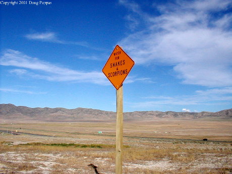
The Lincoln turns south at Wendover, following US 93A and US 93 to Ely. Between Wendover and McGill, a northern suburb of Ely, I drove more than 100 miles without passing a single operating business. As the region's commercial center, Ely has more than its share of operating businesses, but it's still the sort of place people only find while on their way to somewhere else.
Like me, for instance. Tomorrow I drive what Life once dubbed "the loneliest road in America": US 50 across central Nevada. Then after a quick swing through Reno and an attempt to find the original route across Donner Pass, it'll be time to turn south. I'll drive old Route 99 as far as practicable towards Los Angeles -- I'd like to spend some time on the road I was originally planning to drive from Mexico to Canada...
Go to the next day
Back to NEWS FROM THE ROAD menu
Back to ROADSIDEPHOTOS.COM home page